Oh Boyaca! by bikepacking.com
We rode the Oh Boyaca! route by bikepacking.com in February 2024 and we made some notes along the way for anyone that might want to ride it in the future.
The route
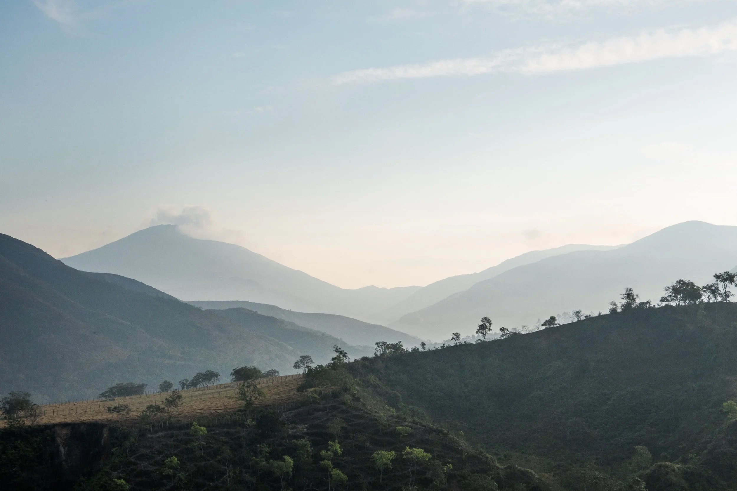
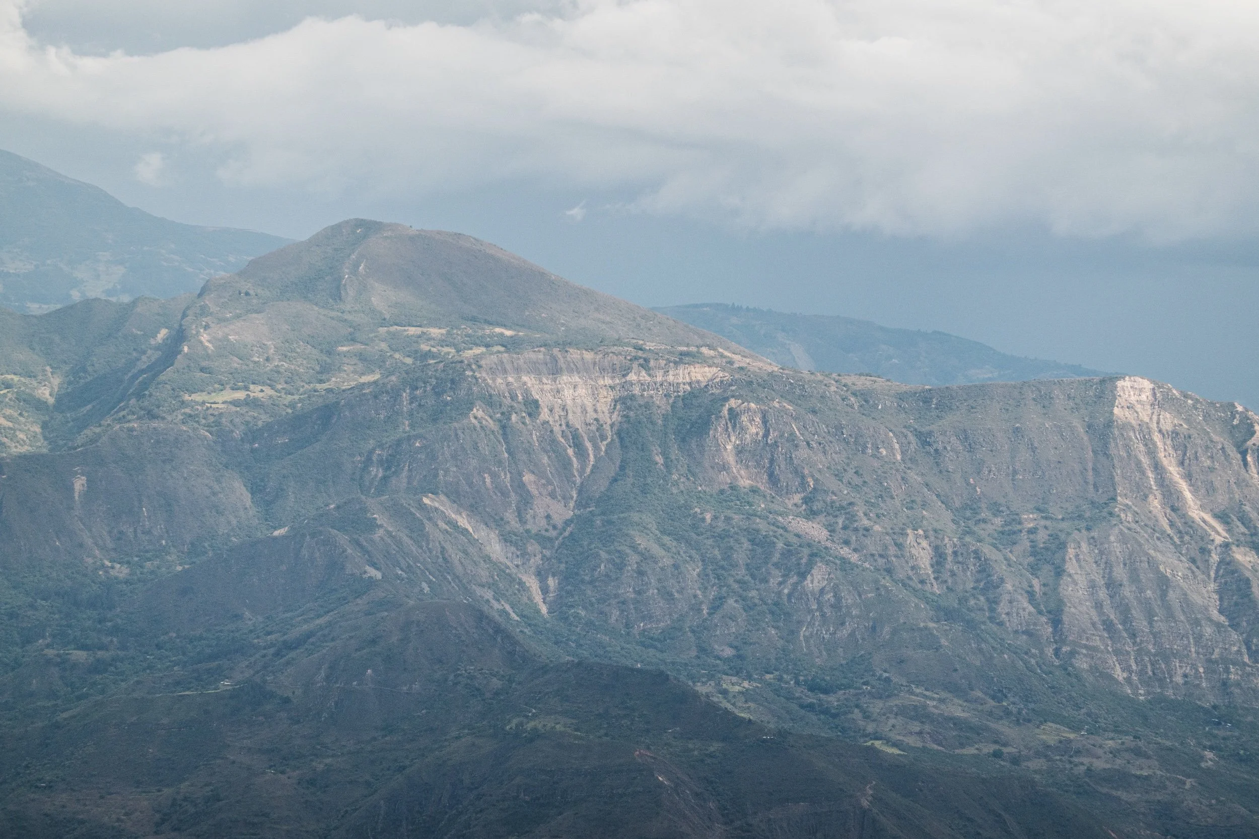
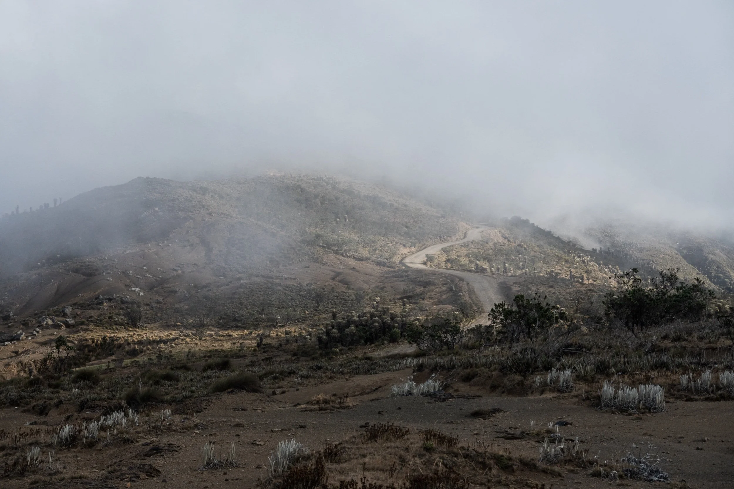
The Oh Boyaca! will take you to a more remote part of Colombia, but never uncomfortably far away from towns and villages. If you start riding in San Gil, you will gradualy be riding towards higher altitudes with the highest point being just over 4000 m. Clear skies will give you views over the snow capped peaks of the El Cocuy National Park and you get to ride through the beautiful surrounding páramo.
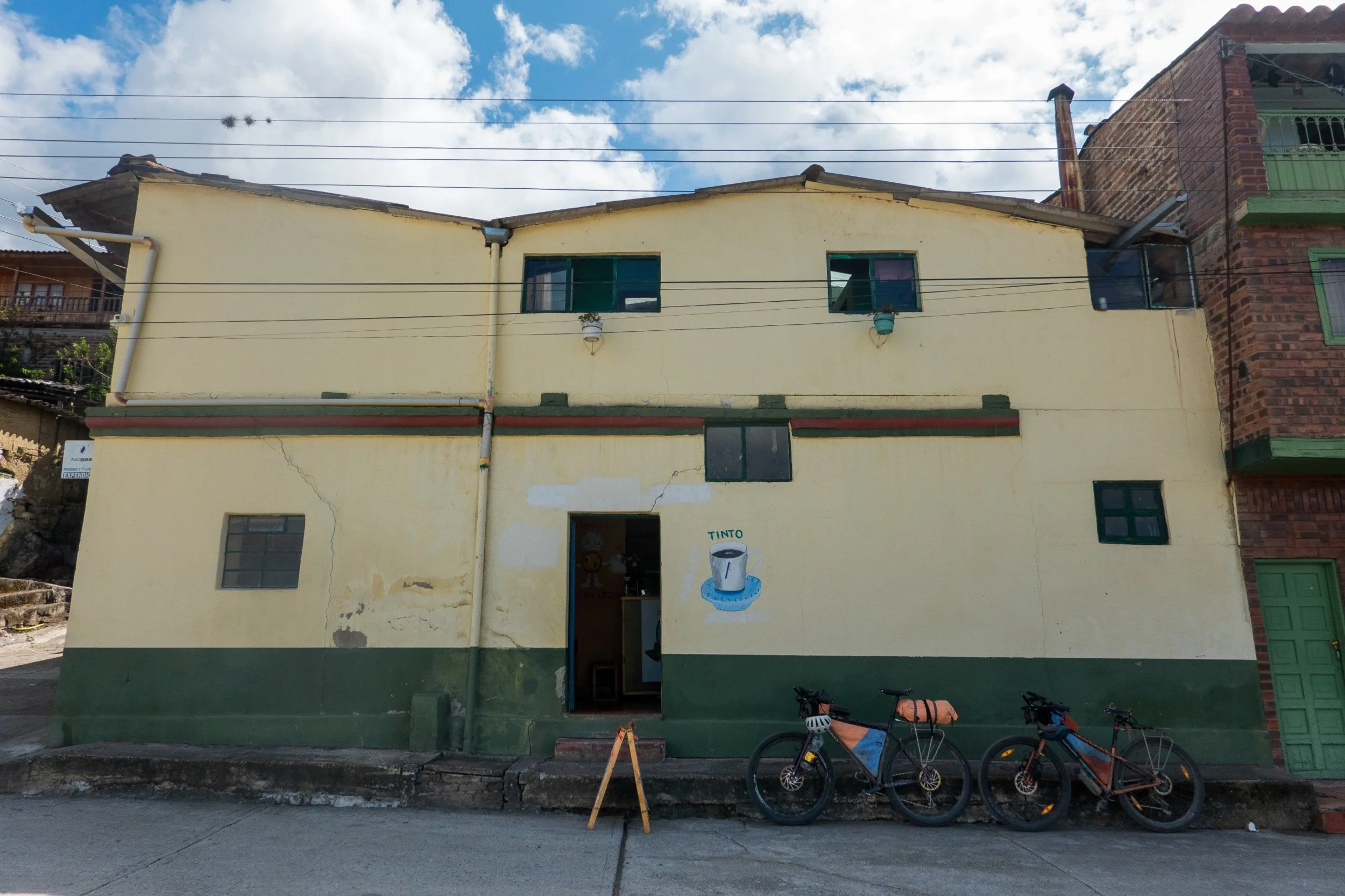
Resupplying is pretty easy since you pass towns quite regularly. Most towns offer some accommodation too. If you pack light and ride some longer days, it would be possible to leave your tent at home and stay in small hotels every night. The longest we had to carry food was just under 2 days.
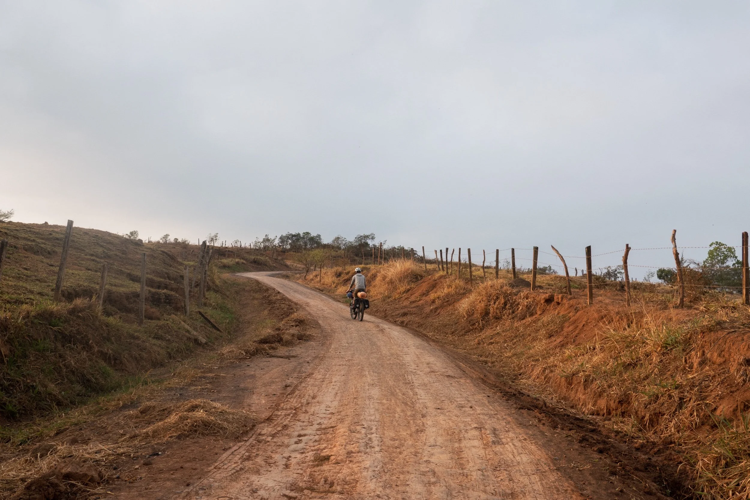
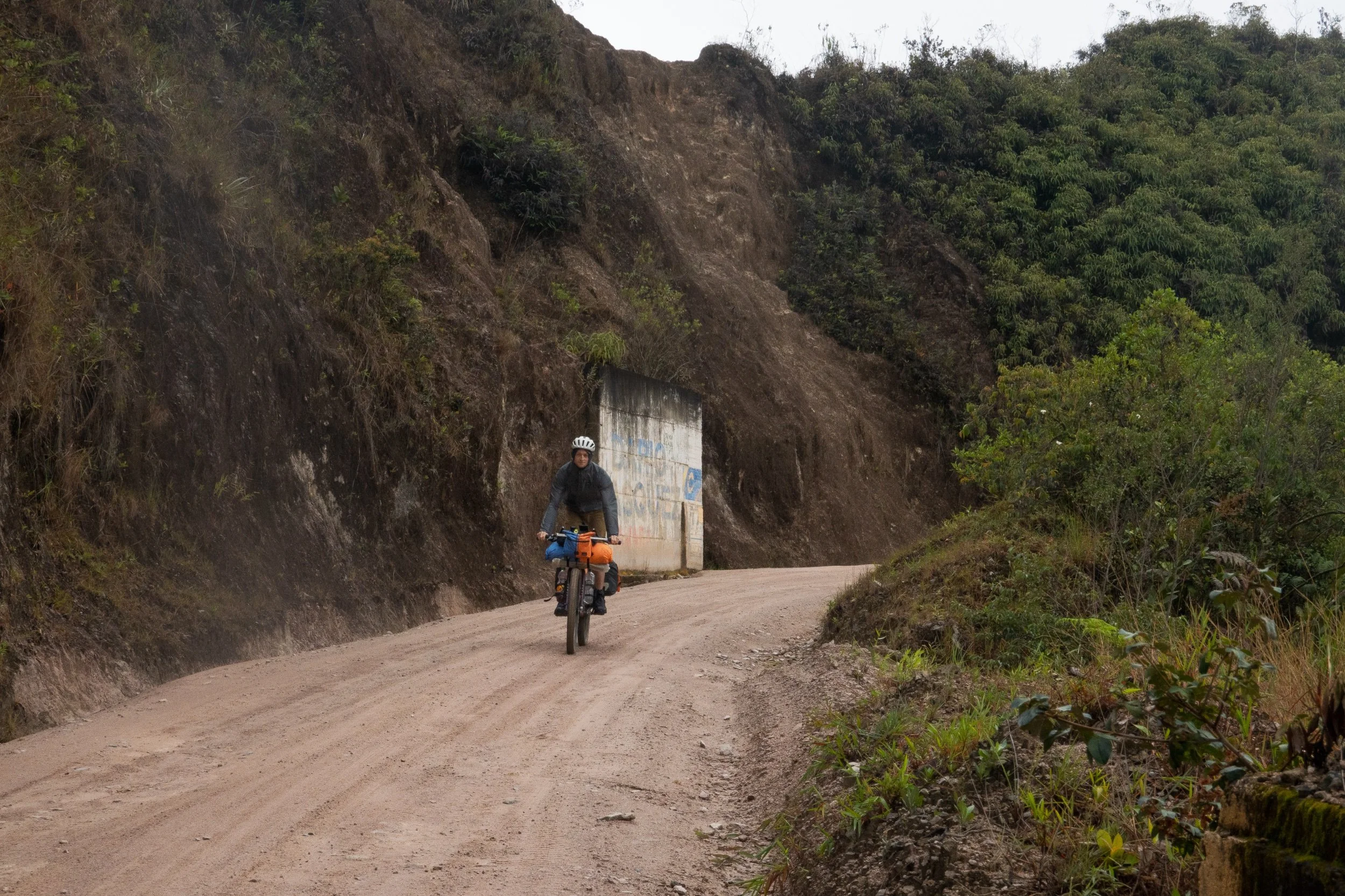
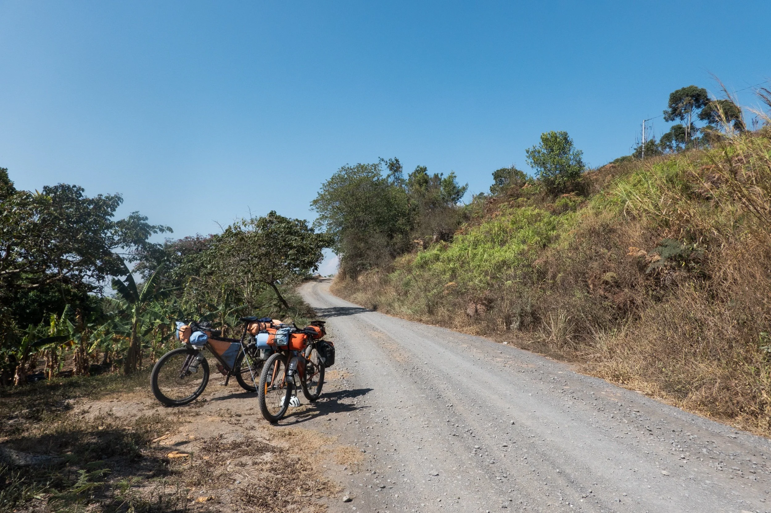
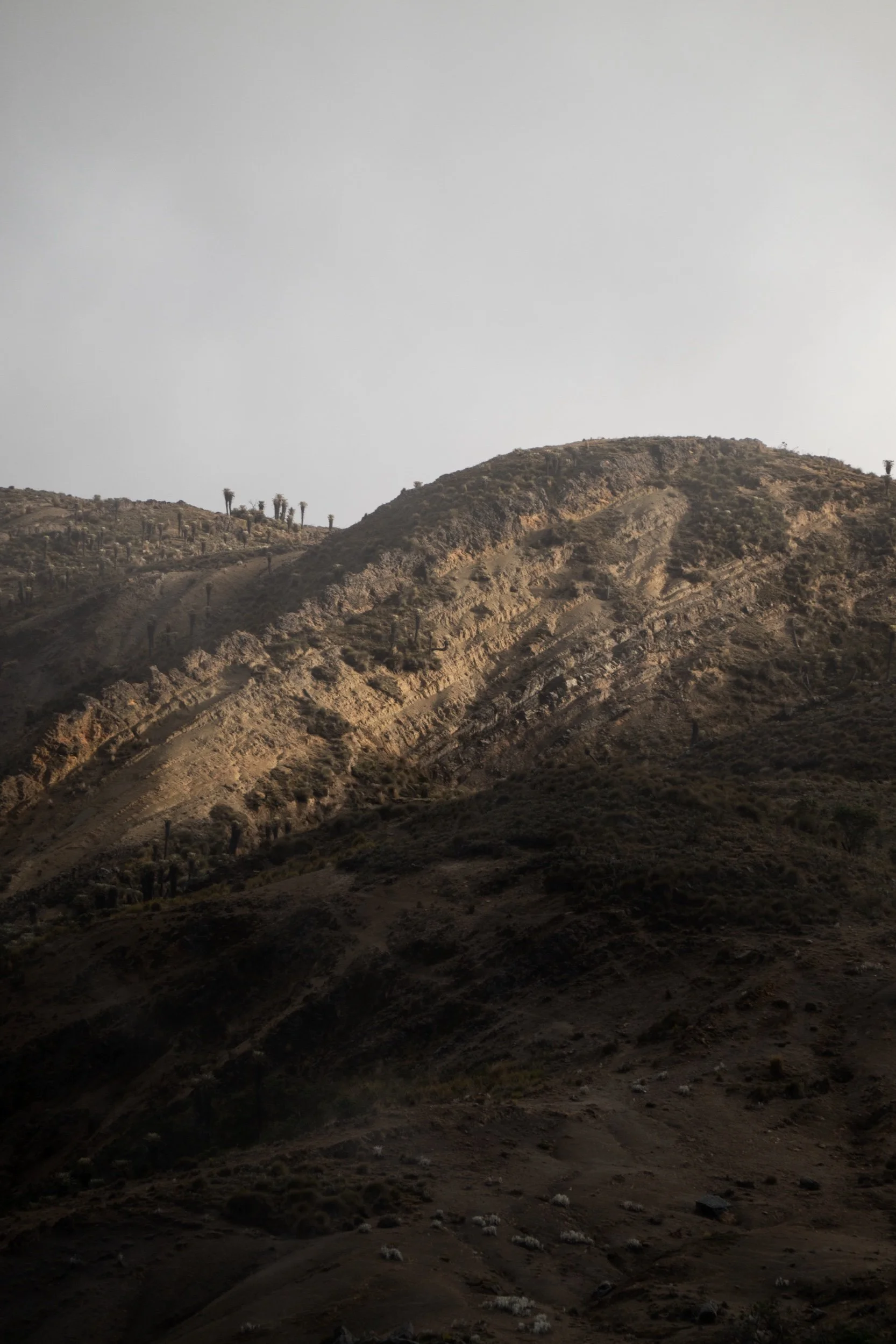
Most of the route is unpaved double track with some paved parts in between. Almost everything is rideable, although there are some short, steep sections that might have you pushing the bike for a bit.
We stuck to the GPX made by bikepacking.com, so we recommend downloading it from there for the most updated version.
Logistics
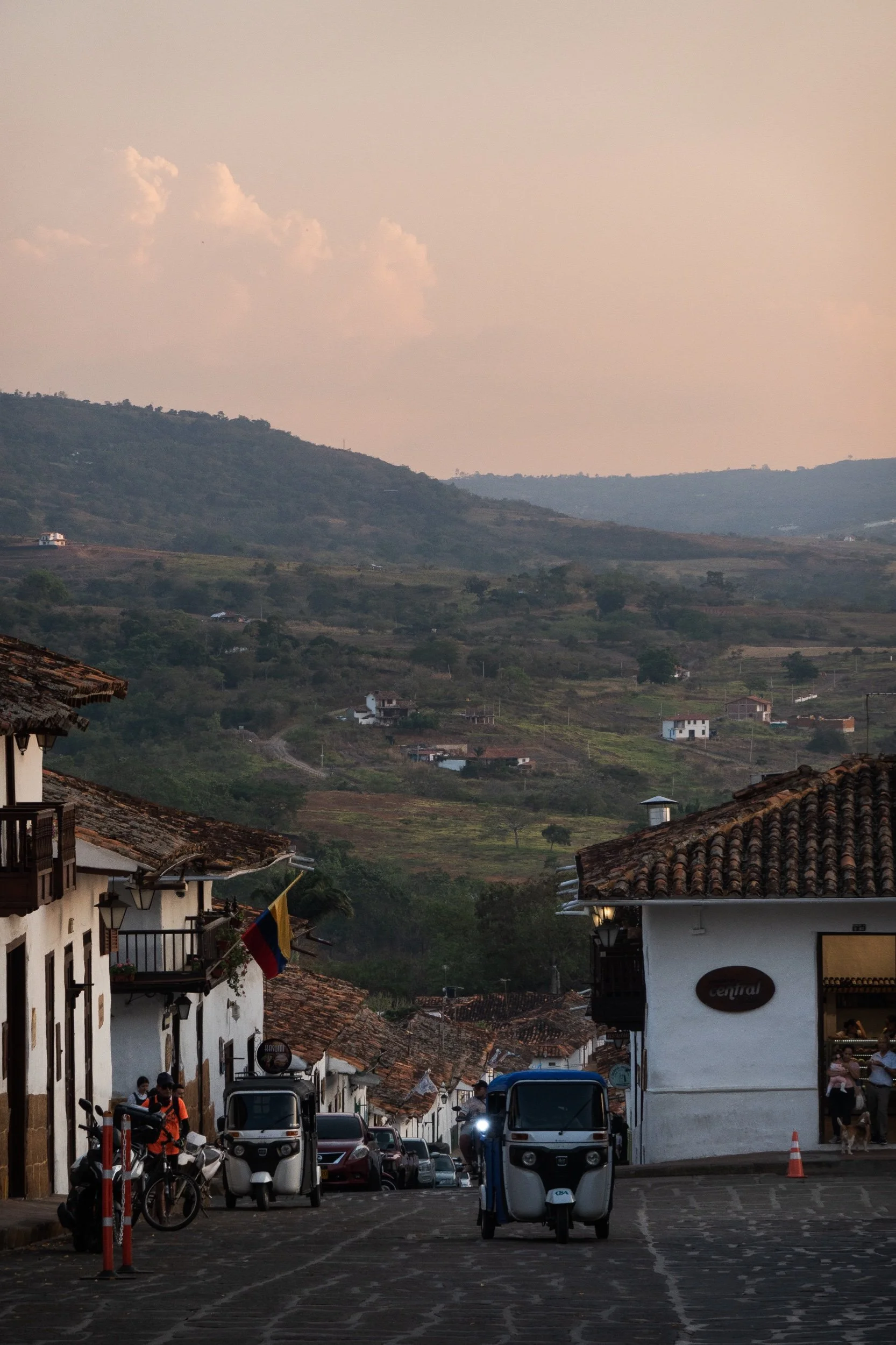
On bikepacking.com the route officially starts in Barichara, a colonial town in the Santander region. It's without a doubt a lovely place to start your trip and is easily accessible by bus from Bogotá.
However, there are some amazing places in the same region that the Oh Boyaca! does not include. When riding southbound, I would highly recommend to start riding in Bucaramanga or the smaller neighbouring town of Girón. Bucaramanga is a rather big city with an airport and is without a doubt very easy to reach by bus. Starting here will add 2 or 3 days to the route.
Our route went like this: from a Warmshowers host in Girón, we rode a short afternoon to Cañon de Las Iguanas. There you can camp next to a tienda for a small fee. Because this region is pretty hot, we woke up early to descend to the huge Chicamocha Canyon and afterwards start the long climb to Zapatoca. This is a beautiful village that doesn't attract the same amount of tourism as Barichara. We stayed there for one night and continued to Barichara the next day. This stage was mostly unpaved but definitely one of the best days of bikepacking we've had in Colombia. Take your time to look around at the small but well kept colonial villages of La Fuente and Galán. From there it is a long climb to Barichara, the actual start of the Oh Boyaca! route.
Our setup
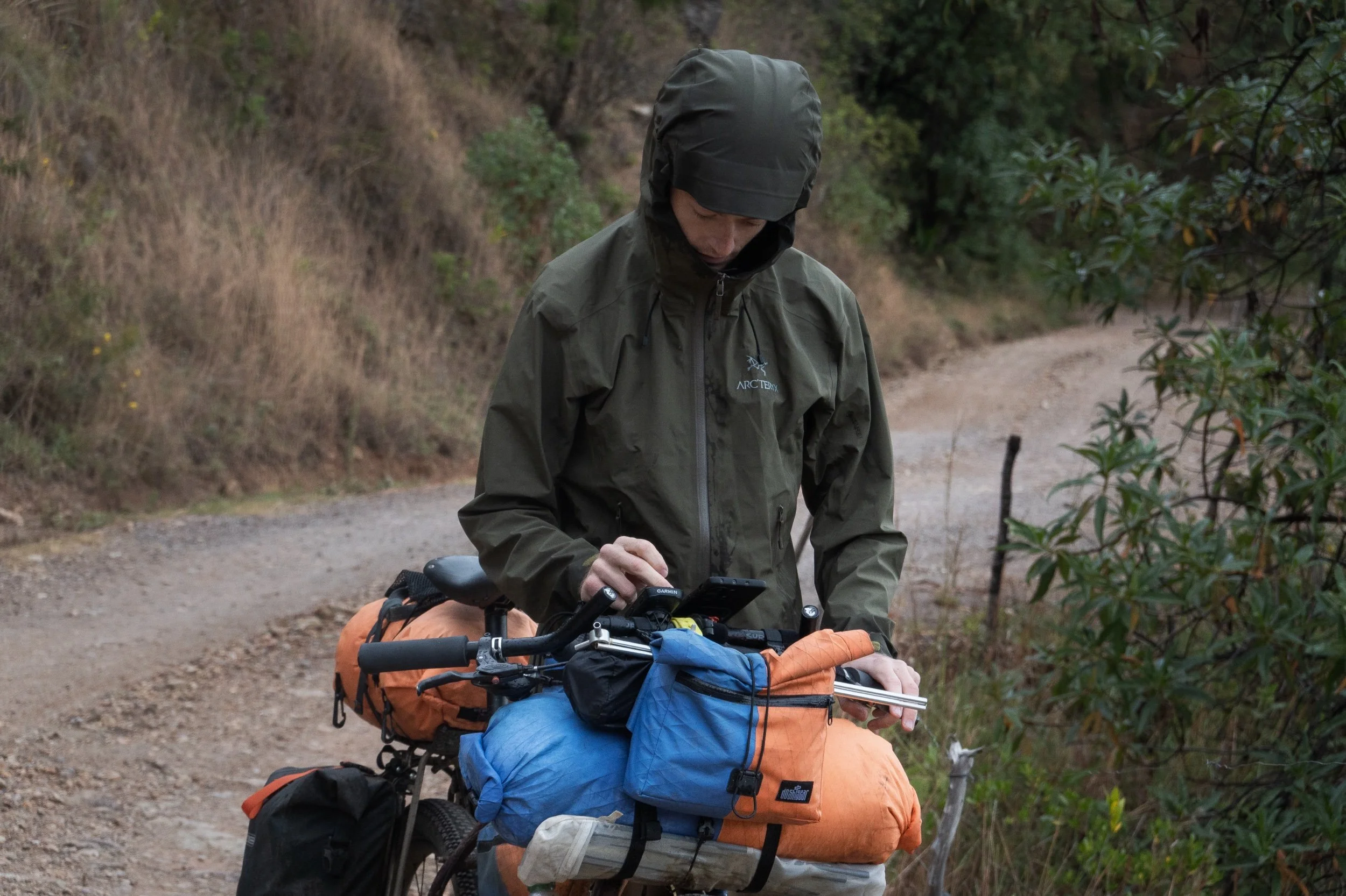
We are on a long-term bikepacking trip through South-America so we are basically carrying all the gear to be able to camp at temperatures between -10°C and 40°C. This means we were probably riding heavier bikes than what would be ideal on a route like the Oh Boyaca!, but we tried to keep it our packlist minimal.
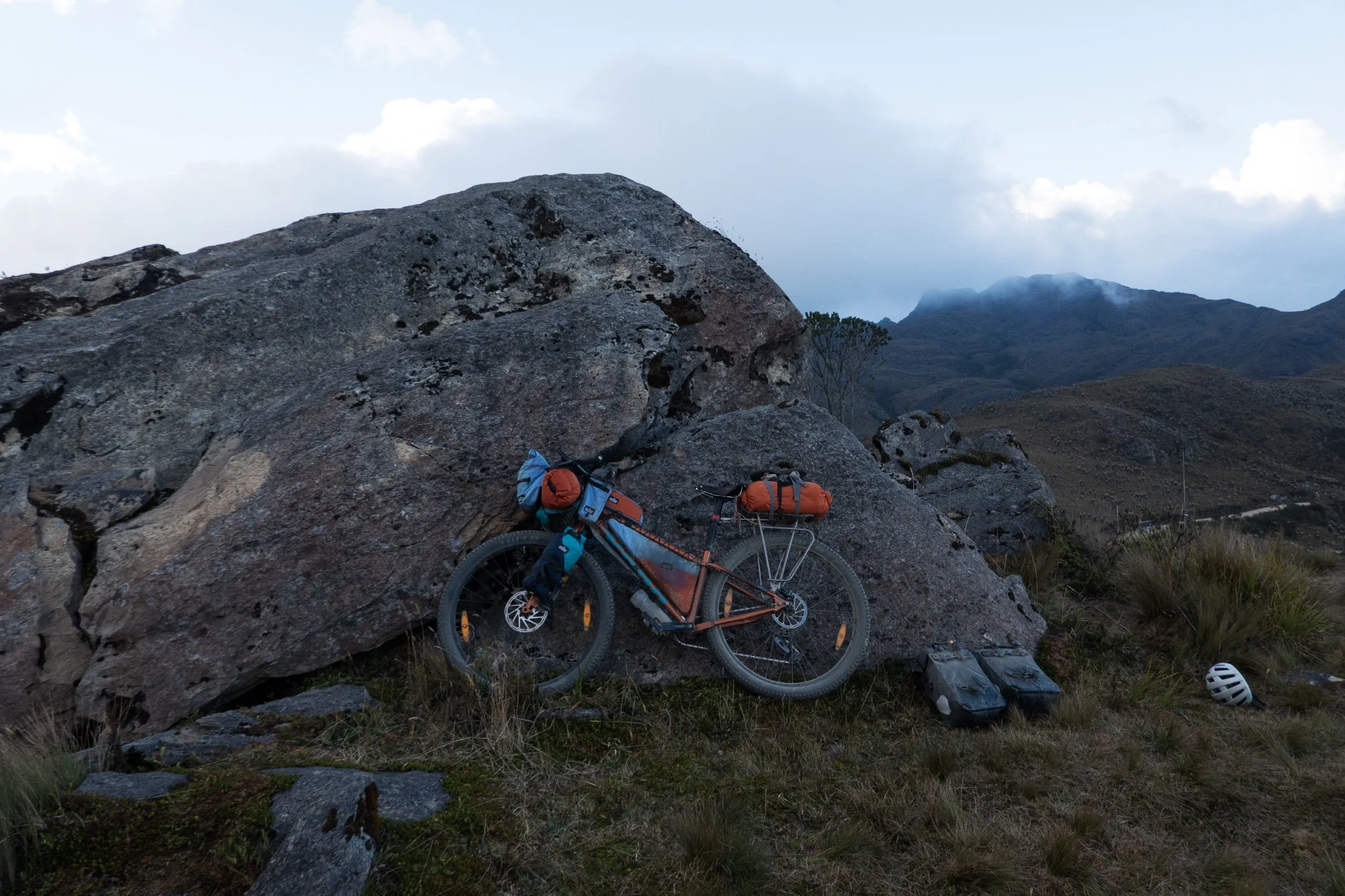
Our bikes are rigid steel mountainbikes with 29x2.6 inch tyres. We use a rear rack and Ortlieb gravel packs in combination with the ‘traditional’ soft bikepacking bags from my small brand Dosh Gear. This includes a full frame bag, a handlebar roll, a top tube bag and some stem bags.
For this route I would definitely recommend to use the widest tyres possible and to fit a small chainring upfront for the long (1000m+) climbs. Front suspension would definitely be welcome on some of the bumpier descents, but a rigid fork will do fine too if you play with your tyre pressure a bit. We even met a guy who rode this route on a gravel bike - although he was travelling very light, he said he felt underbiked at some moments.


Oh Boyaca! - Day by day
Day 1: Barichara - (9km before) Mogotes
The route leaves Barichara and immediately short steep climbs follow. Although most of this first section is smooth dirt and gravel, the steepest parts are often paved, I assume for during wet season. The riding is actually super nice and there is almost no traffic. It’s best to stock up on food in Barichara as there are no tiendas (shops) on the uphill.
The downhill to San Gil is fun but a little rougher than the uphill. The first half is unpaved, second half asphalted until the city. We only briefly stopped in San Gil to resupply as we were hoping to camp that night.
To leave San Gil, we took the "easy" route which is paved instead of a notorious steep off-road section like mentioned on bikepacking.com. The road we followed was a relatively uninteresting climb to 1700 m where the "steep" and "easy" route come together again. From that high point the paved road to Mogotes was really beautiful and we caught first sight of the mountains we were heading towards. No worries about food needed, there are plenty of tiendas between San Gil and Mogotes.
About 9 km before Mogotes we found a small abandoned house on the side of the road where we camped for the night.
Day 2 and 3: Mogotes
The day after a successful night of camping, we arrived in Mogotes early in the morning. I was not feeling well and didn't have an appetite so we decided to find a hotel and stay there to rest.
We rode to Hotel el Paraiso (it was the first one we came across) and paid 70.000 COP for the both of us per night. We didn't look into any other options but we found this to be rather expensive, altough it wasn't so bad. There is no hot shower, but that seems to be the rule in most of the more basic accomodations we stayed at.
During the day my symptoms got worse and when I had to throw up, it was clear that I wouldn't be able to cycle the day after so we stayed two nights in total.
Day 4: Mogotes - Onzaga
When we woke up, the rain was pouring outside and after arranging our stuff, it didn’t seem like it would calm down. We decided not to sit it out because we had no clue how long it would take. From Mogotes onwards the road is unpaved and traffic was very minimal. It kept raining during the climb out of the valley, luckily the other side of the mountain was dryer and we enjoyed the downhill.
We had lunch in San Joaquin and continued the route to Onzaga where the clouds and mist made way for the sun, meaning we had more vistas. The road out of San Joaquin followed the river all the way to Onzaga with some more gentle climbing and descending and was by far the nicest part of today's route.
In Onzaga we found a room in Hotel Hunzaa for 60.000 COP. It's a very clean place and the room was a bit bigger than the one we got in Mogotes, so we were happy to stay here. No hot shower though.
Day 5: Onzaga - Soatá
On today’s menu were two big climbs so it was definitely harder than yesterday. We were back on unpaved roads and the climbs had a lot more steep sections than yesterday. For us, this meant we went slower going but with lighter setups it might not make such a difference.
The first climb was really nice and overlooked the valley of Onzaga. The second climb took us up in a smaller valley all the way to 3000 m where we crossed the border between Santander and Boyaca. Around noon clouds set in and by the time we got to the top it was pouring rain.
Luckily the downhill was rather smooth for an unpaved track and the rain stopped as we were descending. The second half of the downhill did have some rougher sections though, which was proven by some tubeless tyre issues on Nore's bike.
Soatá is one of the bigger towns we passed since San Gil and should have all of the amenities you might need. We stayed in Hotel Cachipay which has clean and spacious rooms with a hot shower. We payed 60.000 COP for the both of us.
Day 6: Soatá - San Mateo
In order to leave Soatá you start with a descend of 700 meters until you reach the bottom of the valley. The first part of the downhill is a bit rough but doable. Afterwards, the long climb of the day begins. It follows a paved road from the bottom of the valley at 1360 m all the way up to 2870 m. Because it’s paved, the climb has a bit more traffic than we would have liked but it wasn’t too bad because the cars gave enough space when driving by.
The road passes Boavita en La Uvita, two small villages where you will find almuerzos. We can recommend a small tienda with empanadas and baked goods in La Uvita. If you stand in front of the church, it is on the right corner of the same block. During the day, we had pouring rain for about two hours so it was nice to have some warm coffee and pastries there. By the time we were leaving again, the rain stopped and our clothes were dry by the time we reached the top of the climb. After La Uvita, the road gets a lot calmer.
Once we finished the climb, a 14 km long descent (and a little uphill at the very end) took us to San Mateo. The downhill is very uneven but relatively fast, switching between pavement and rough gravel a couple of times.
In San Mateo we found Hotel Capilla on the main square. I couldn't see it on Google Maps, but I think it was well worth the 60.000 COP for the clean, cozy room and hot shower. We were not able to take the bikes inside but the owner showed us to a garage with a locked gate one block away, where we could store our bikes safely.
Day 7: San Mateo - El Cocuy
From San Mateo we continued on the paved road towards El Cocuy. This entailed two climbs which were not very hard, but we were starting to feel our legs burn after the past couple of days full of climbing. Although it was overcast we barely had any rain which was nice.
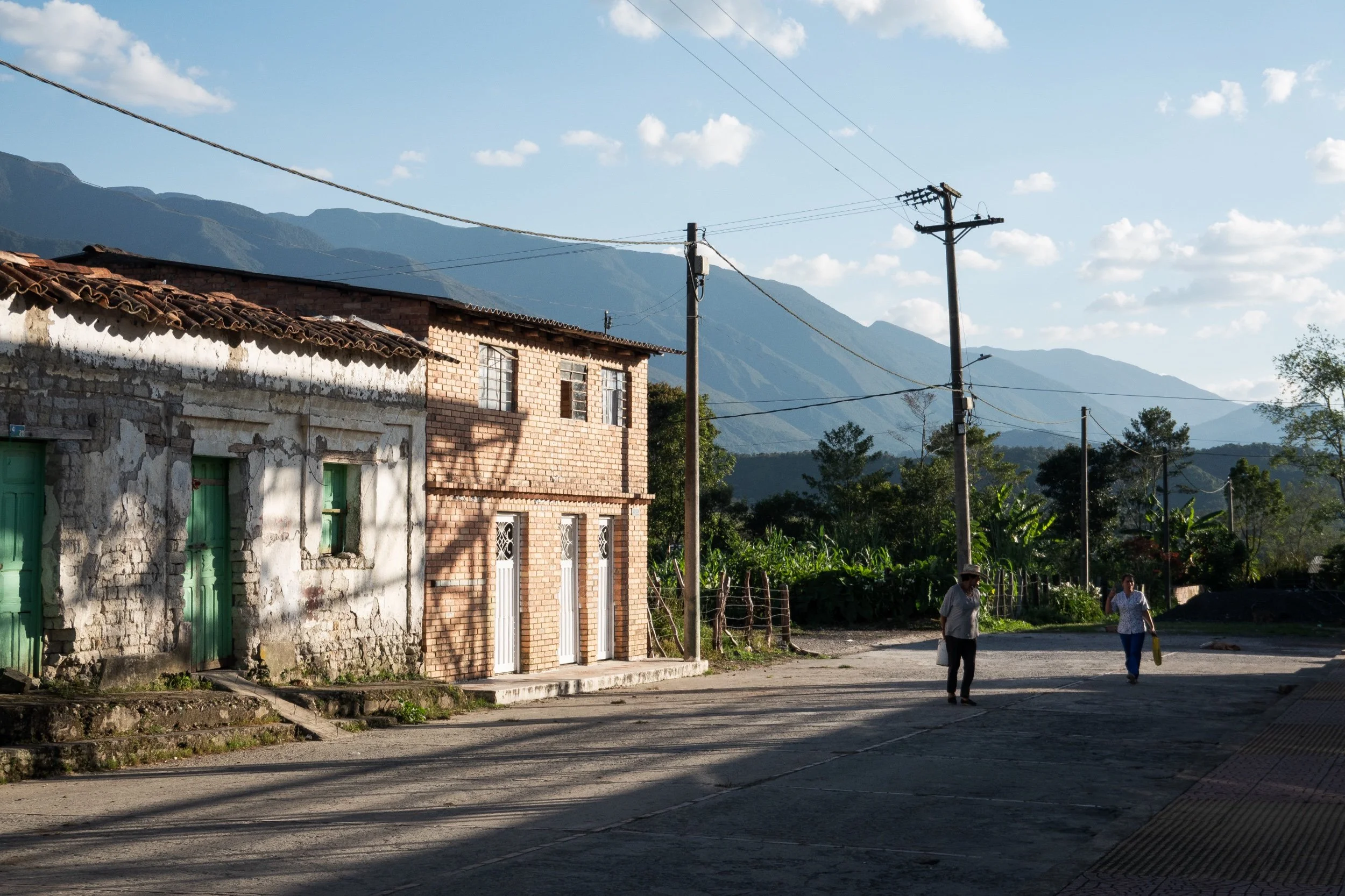
We picknicked on the plaza principal of colourful, vibrant town of Guacamayas and continued to El Cocuy in the afternoon. Although described as a tourist town because it serves as an entrance to the El Cocuy National Park, it is definitely not the same level of touristy as Barichara or San Gil. However it still has all the necessary ameneties one might need.
We found GLL Hotel on Google Maps and managed to convince the owner to let us stay for 60.000 COP per night instead of 80.000 COP, but only if we would stay 3 nights. The place is quite new and cosy, with a more modern bathroom and has a hot shower. The only thing is that the entire building seems to be made with OSB plywood, which isn't great for noise isolation from other guests. In any case we sleep with earplugs most of the time so it wasn't a big issue.
Day 8: El Cocuy loop
Bikepacking.com mentions several ideas on how to tackle the loop that begins and ends in El Cocuy before continuing the rest of the Oh Boyaca route. We decided to leave most of our bags in the hotel and ride the loop in one day without all the extra weight.
This was definitely a good idea as the route proved to be pretty tough with some steep and loose climbs. It was also a nice break from our regular cycling days and our bikes felt a lot more playful, especially when going downhill.
We rode the loop clockwise so we arrived in the only other town along the way, Güicán, in the morning. We got there at around 10 am and found what might be the best empanada shop we have experienced since we arrived in Colombia. It is situated on the righthand side in one of the first buildings when entering the village using the gpx file from bikepacking.com. It is not marked on Google Maps. Because we got there relatively early, the women working there were still in the process of making the empanadas so we tried them fresh out of the oil. 10/10 would recommend.
After this amazing second breakfast we pushed onwards to the highest point of the loop at around 3800 m. Afterwards it's downhill all the way back to the town of El Cocuy. The descent was actually one of the best we had on the Oh Boyaca route as it is relatively smooth and not super steep, which was loads of fun with our unloaded bikes. Only the very last stretch is a bit bumpy.
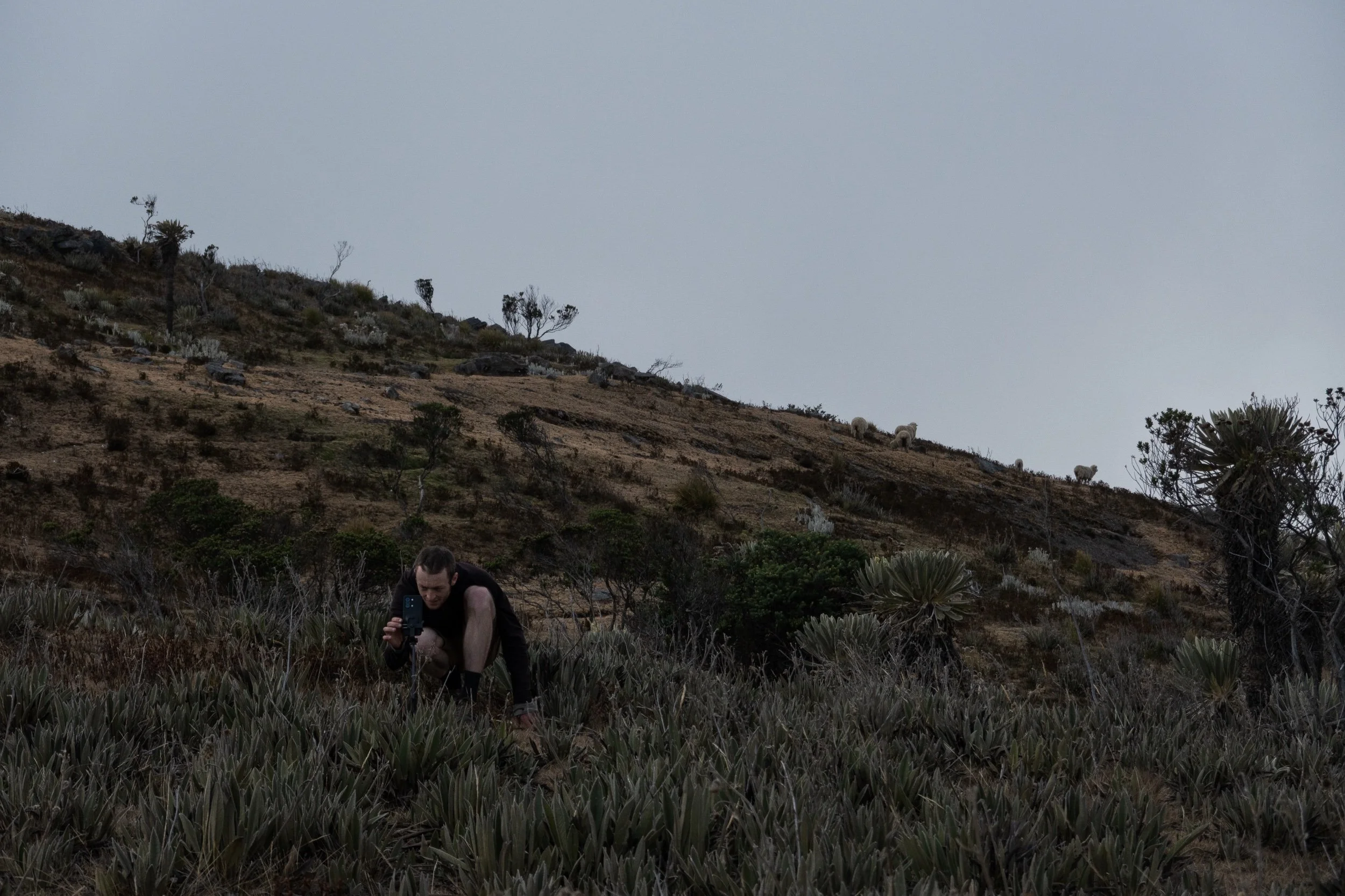
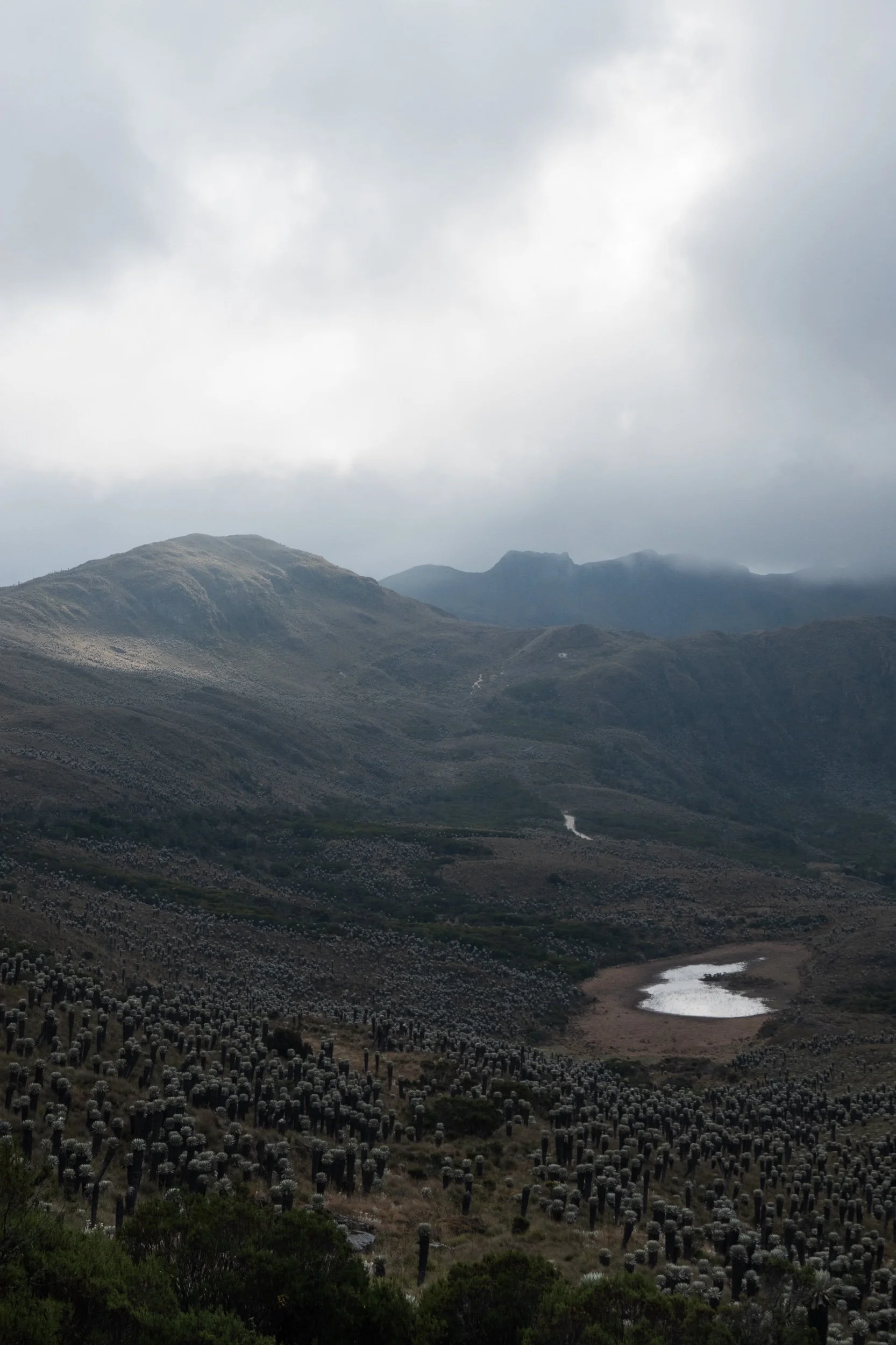
The route was unpaved the entire way and had very little traffic. You will see more people on horses than cars. With blue skies you get to see the +5000 m snow capped peaks of El Cocuy National Park on this loop. Luck was not on our side as those peaks were covered in clouds the entire day. Nevertheless we had plenty of sunshine which made for a beautiful day at high altitude.
Day 9: Time for a rest day in El Cocuy.
Day 10: El Cocuy - Paramo camp spot
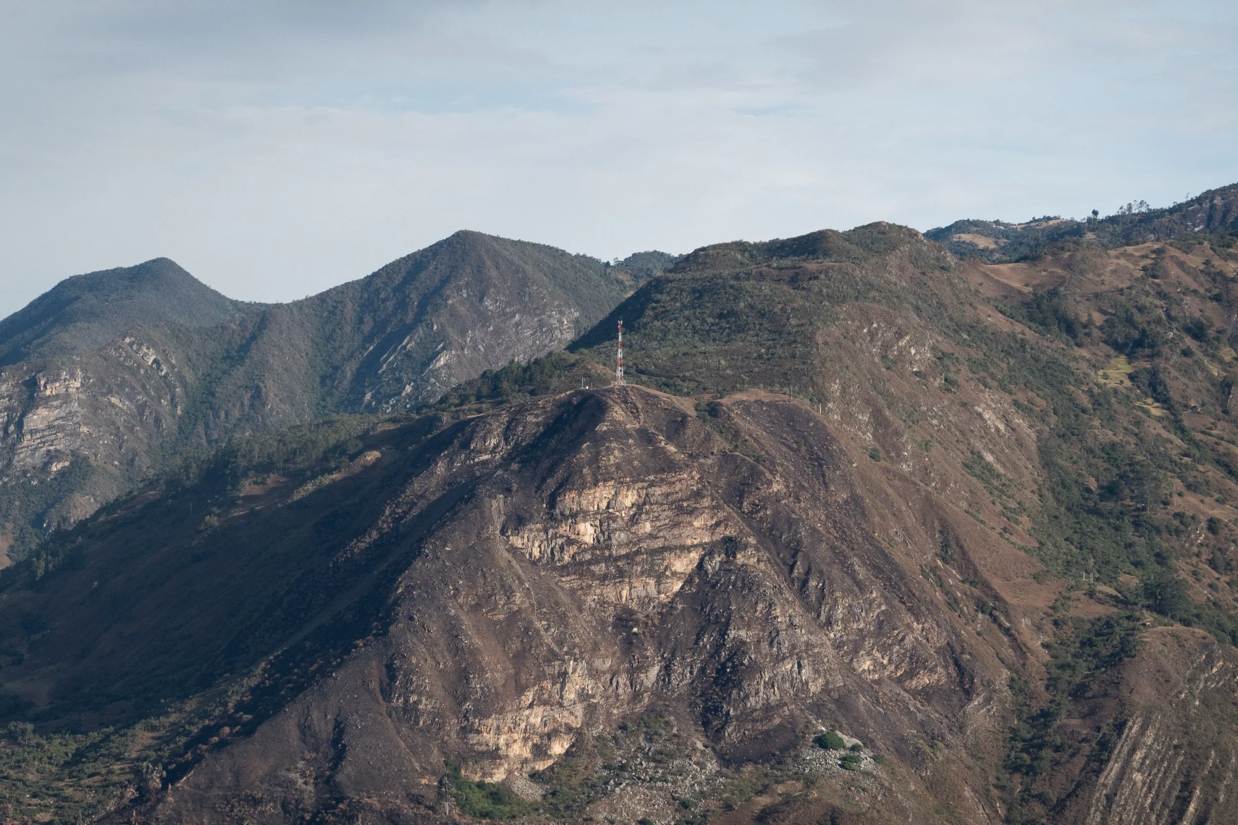
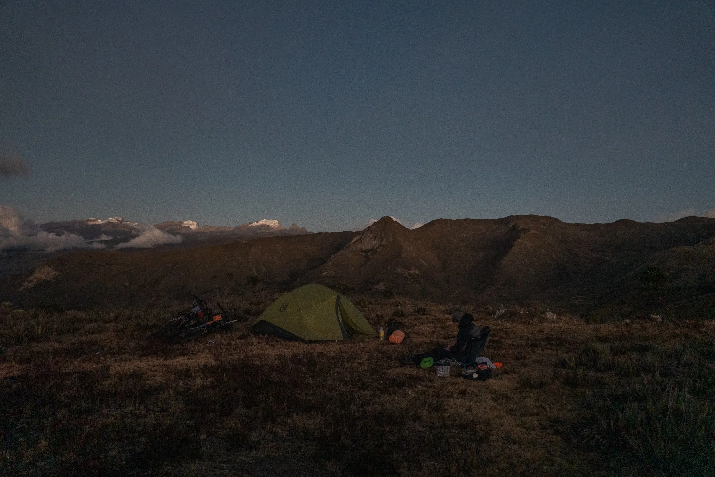
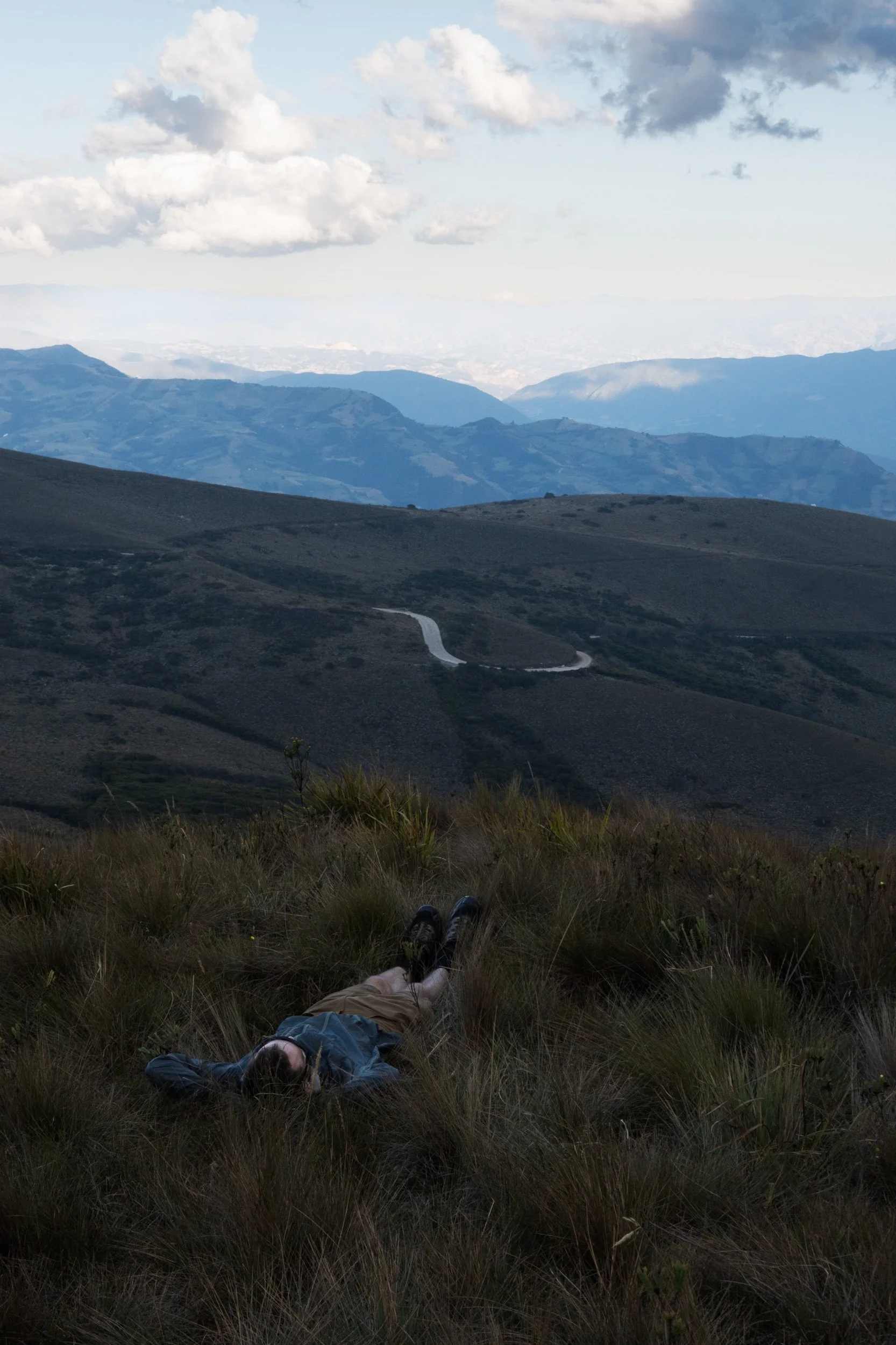
After taking a rest day we climbed out of El Cocuy towards the high point of the Oh Boyaca route at 4100 m. We read online that it is common to camp over there so that was the plan. This meant that it would be a full day of only riding uphill.
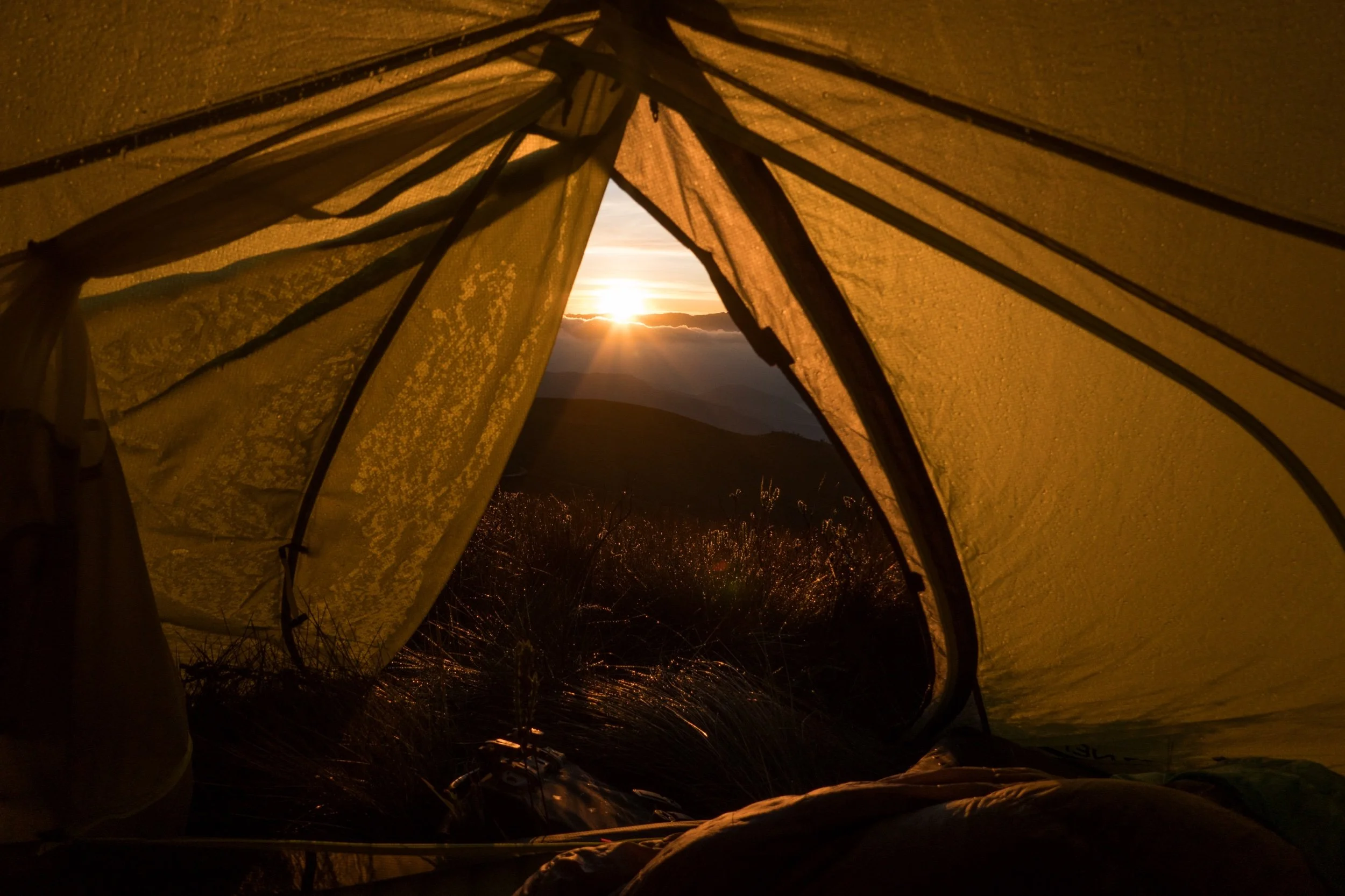
The climb was actually quite pleasant with not too many steep sections and almost no traffic. The only thing that could get in your way would be the altitude or the weather. Luckily we reached the camp spot without too many problems and pitched the tent with a view over the vally we just climbed out of. For the first time we actually got to see the snow capped peaks in the background, as is was the first clear day since we got to El Cocuy.
We camped close to the road and just after dusk some shepherds brought us a visit. They didn't seem interested in a conversation and just continued their way down the valley.
After having our dinner the temperatures dropped quickly and we put on our warmest clothes, before getting in our sleeping bags. A strong wind blew the entire night and messed a bit with our sleep, but our tent held up fine and we eventually woke up in the morning to see the magnificent view we were hoping for.
There are no options for resupply between El Cocuy and Chita.
Day 11: Paramo camp spot - Jericó
From the highest point of the route, a long and pretty rocky downhill took us to Chita where we got some groceries and had some "papas" - balls of fried dough with rice, eggs and peas inside.
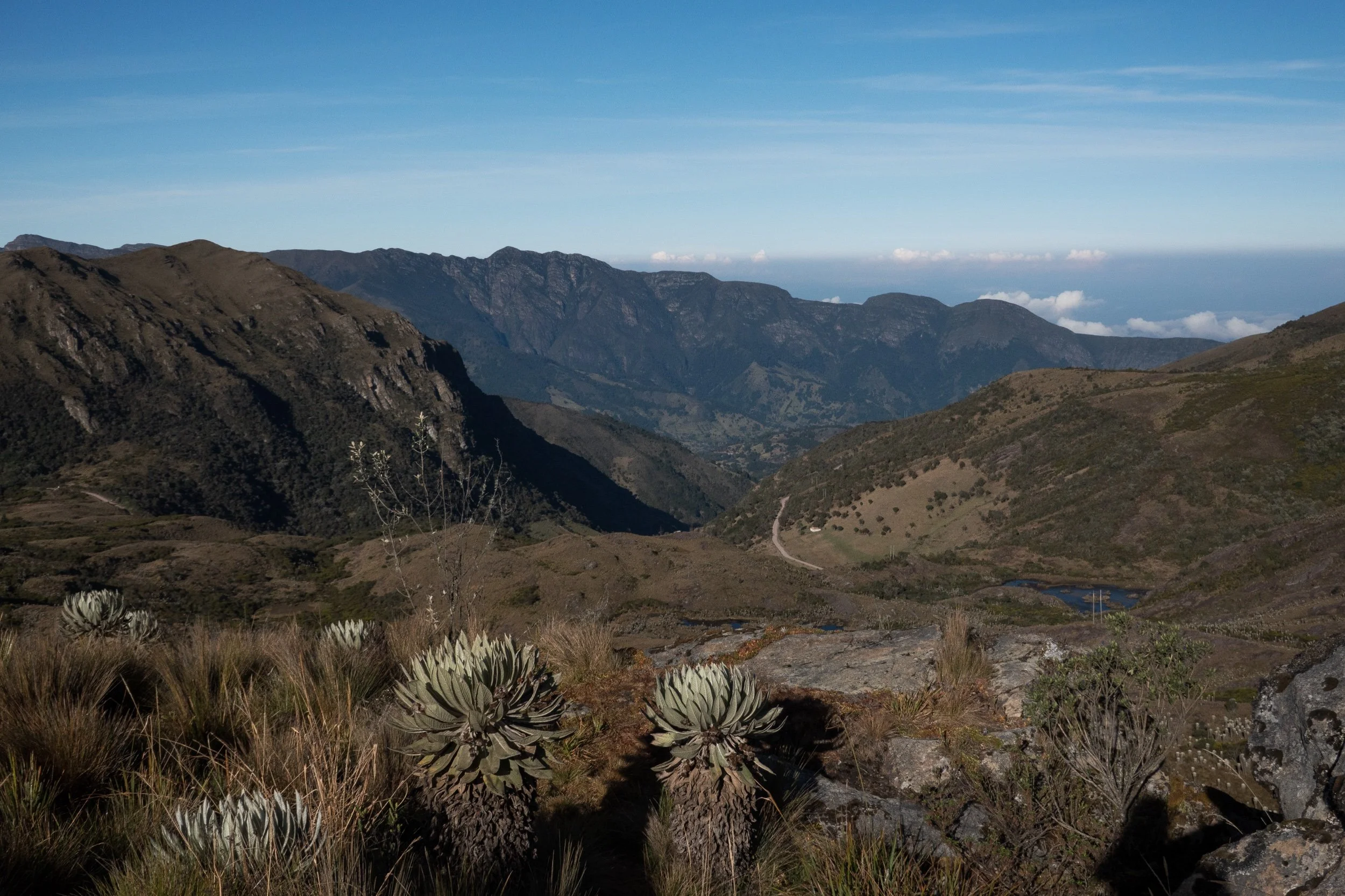
Afterwards we continued on the road towards Sotocá, which entailed more climbing than we expected. Especially the short yet steep parts were difficult for us with the weight we were carrying. This part of the route is beautiful as you kind of stay on the edge of a huge valley the enitre time, which garantees good views.
There are lots of small farms dotted around, but I don't think we passed a tienda along the way so it’s best to resupply in Chita. While not too crazy, this part of the route was definitely rougher terrain than what we saw before. People on gravel bikes might have a hard time (especially on the downhill), although it would still be doable.
We ended up going slower than we'd hoped so we decided to try and find a camp spot earlier along the route. iOverlander mentioned a camp spot very close to Jericó, so we headed that way. It is situated right outside of town next to a very quiet road (we hardly saw any people passing by). The camp spot was a bit hidden and actually pretty well sheltered from the wind.
Day 12: Jericó - Paz de Rio
We were in need of a slower day so we decided to keep our total ascent under 1000m for a change. After a short paved climb out of Jericó we followed a relatively bumpy downhill to Socotá where we had some pastries in a bakery and restocked on fruits and cookies.
Afterwards relatively uninteresting paved road (with some short but gnarly unpaved sections) leads to Socha and all the way down to the mining town of Paz de Rio where we found a hotel in the early afternoon.
We stayed at Hotel Aragut House for 60.000 COP which was a fine place with a hot shower and decent WiFi. The room was big enough for both of our bikes but we had to carry them to the first floor.
Day 13: Paz de Rio - Páramo
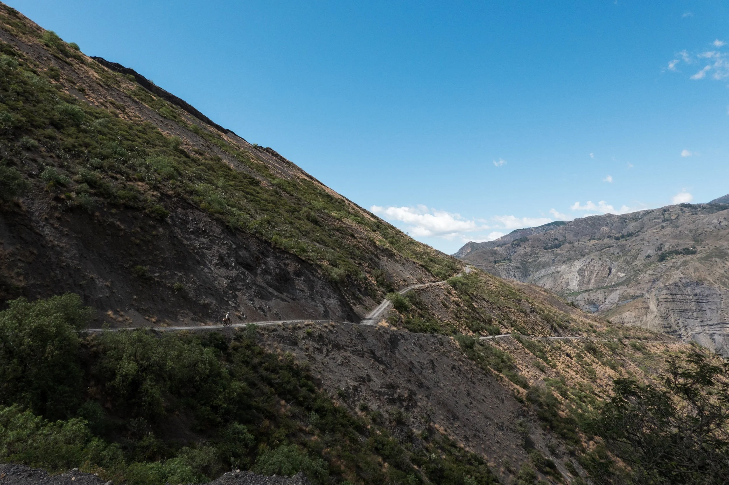
We left Paz de Rio at 6 am because we knew a long climb was on the menu today and we wanted to camp on the highest point of today's route. We followed the paved road to Belèn. Beforehand, we read that it might be a busy, and even dangerous, road because of the heavy traffic. There was indeed some traffic, but nothing too crazy. The road goes through a canyon and you can see some of the mining activity that is still common in this area.
After a short climb, a pleasant flat section continues all the way to Belèn, where we had a coffee and went to the supermarket to resupply for the coming day and a half.
Next up, a long but beautiful climb takes you to 3800 m, but almost all the way up there is a great view over the valley on both sides of the road. When we got to the top, I found a small hiking path that continues a bit higher up and I thought it would make for a really cool campsite. It took some effort to haul the bikes up there, but it was a great place to spend the night, albeit a bit windy and not super flat for our tent.
Day 14: Páramo - finca close to Palermo
We woke up on the Páramo with an amazing view over the valley and the snowy mountains of El Cocuy, which we could still spot from a distance because the sky was so clear. It was cold though, so we decided to not hang around too long and start the downhill into a pristine but very secluded valley. We saw only very few people and there was no phone reception.
The downhill proved to take longer than expected because there were some steep climbs hidden in the elevation profile that Komoot did not display very clearly. When we got down to the river, it was time to begin probably the hardest climb of the Oh Boyaca route. It is a steep, loose track that was really demanding, but we managed to get to the top around 4 pm.
This was good because we still had some daytime left to decend to a lower altitude where we could camp in warmer temperatures. This downhill is particulary bumpy, so we made relatively slow progress. With little daylight left we were desperate for a place to pitch the tent, but as per usual all the land is private and is fenced with barbed wire.
We found some people working outside on their farm and asked them if they knew a place wher we could camp and they promptly pointed to a gate to access a small meadow. Easy as that.
Day 15: finca close to Palermo - La Palma
After packing up our stuff we made our way down to Palermo on the bumpy track. Palermo is really small but a nice place for second breakfast. We were there on the morning of Ash Wednesday and actually had to wait a little bit for tiendas to open, as almost every single inhabitant was in the church at the time of our arrival.
Afterwards we continued along a beautiful unpaved road next to the river towards Gámbita. A short climb and another bumpy decent later we got to the town for a nice lunch. The sun was burning hot at noon, so we asked the kind lady of the restaurant to top up our water bottles for the coming climb. During the ride after Gámbita, we crossed a river but it was too steep to go down to in order to fill our bottles once more. Here and there, you will come across some small streams, but don’t wait too long to refill because you never know when you ride by the last opportunities.
The track out of Gámbita is a much smoother dirt track, which was definitely more comfy to ride. We got to the town of La Palma where we found a place for our tent on the roofed football pitch. We read on iOverlander that people have camped here before and when we talked to the owner of the nearest tienda, she confirmed that we could pitch our tent there.
The only downside was that there was a football game that night, which meant we didn’t get as much sleep as we hoped. Some interested kids came over and talked with us for a while, but we were mostly left alone by the other people. We were definitely not the first cyclists to spend the night here.
Day 16: La Palma - Villa de Leyva
We woke up early because we wanted to spend the afternoon in Villa de Leyva, have lunch there and take it easy. The morning was really foggy until about 8 am when the sun poked through and rewarded us with the last views of this beatiful valley.
A quiet but bumpy dirt track leads from La Palma to the last serious climb of the Oh Boyaca route. About halfway up, the road was suddenly blocked for some maintenance up ahead. In most situations like this that I have experienced it would probably still be possible to pass by bike, but the roadworker at the junction made it very clear that we would have to make a detour so that's what we did.
Instead of going through the village of Arcabuco, we took a small track a bit more to the North, to eventually end up back on the official route for the final stretch to Villa de Leyva.
The last section after the climb wasn't particularly interesting. We got more dusty on this part of the route than on any other day, mostly because of the passing traffic.
Villa de Leyva is a nice town to finish this ride and I don't think I have seen such a variety in restaurants and accomodations since we arrived in Colombia. You will have no trouble finding accommodation nor food, albeit quite a bit more expensive and touristy than the previous towns.